
With two houses in my family threatened by the Fourmile Fire west of Boulder, I am hungry for information on how their houses are. The TV and print news sites are frustratingly slow, and the best information I found (so far) is on Wildfire Today.
They had a very good map that showed where the actual fires are, according to satellite data. I spent some time looking for the “horse’s mouth,” so to speak, so that I could 1) know whether the map was accurate and 2) get my own updates. I think I found it at the USDA Forest Service site, the page called Fire Data in Google Earth. Here’s the 5:15 ~1:00 PM update:
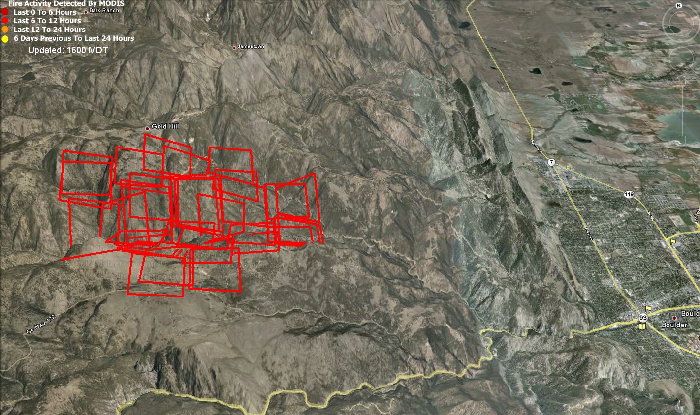

Fourmile Fire hot spots as of around 1:00 PM September 6, 2010
To get your own updates, install Google Earth, then visit the fire data page and click on the “Current” link next to Fire Radiative Power.
The data at 5:15 PM is the same at 8:30 PM, which implies that the underlying data has not actually been updated. But by now, we’ve seen and heard aircraft flying over the fire, so if you know of some better aerial photos or data, please post it here.
The data points are from around 1:00 PM, which is a very long time ago.